Test Page: Difference between revisions
Jump to navigation
Jump to search
No edit summary |
No edit summary |
||
| (24 intermediate revisions by one other user not shown) | |||
| Line 1: | Line 1: | ||
[[Category:Locations]] | |||
[[Test geographic coordinate:: 32°42′54″ N, 117°9′45″ W]] | |||
[[Test geographic coordinate:: 32.715° N, 117.163° W]] | |||
[[Test geographic coordinate:: -32.715°, -77.03201°]] | |||
{{ | |||
#ask: | |||
[[Category:Locations]] | |||
| ?Test geographic coordinate | |||
| format=map | |||
| forceshow=on | |||
}} | |||
{{#ask: [[Test geographic coordinate::+]] }} | |||
Geocode | |||
{{#geocode:40 bd du Pont-d'Arve, Genève}} | |||
{{ | |||
#ask: | |||
[[Category:Locations]] | |||
| ?Test geographic coordinate | |||
| format=googlemaps | |||
}} | |||
{{ | |||
#ask: | |||
[[Category:Locations]] | |||
| ?Test geographic coordinate | |||
| format=table | |||
}} | |||
{{ | |||
#ask: | |||
[[Has coordinates::+]] | |||
| ?Has coordinates | |||
| format=googlemaps | |||
}} | |||
{{#display_map:address=Brandenburg Gate, Berlin, Germany}} | |||
{{#display_map:address=Brandenburg Gate, Berlin, Germany|width=400|height=300|zoom=17|type=hybrid}} | |||
<display_map> | |||
Brandenburg Gate, Berlin, Germany | |||
</display_map> | |||
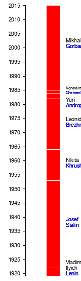
<timeline> | <timeline> | ||
| Line 11: | Line 56: | ||
DateFormat = yyyy | DateFormat = yyyy | ||
Period = from:1919 till: | Period = from:1919 till:2015 | ||
TimeAxis = orientation:vertical | TimeAxis = orientation:vertical | ||
ScaleMajor = unit:year increment:5 start:1920 | ScaleMajor = unit:year increment:5 start:1920 | ||
| Line 64: | Line 109: | ||
Property test: [[Property name::Property value]] | Property test: [[Property name::Property value]] | ||
{{#info: Some text | info }} | |||
Test if Extension:SimpleTooltip is activated | |||
{{#tip-text: text | tooltip-text}} | |||
{{#simple-tooltip: text | tooltip-text}} | |||
Latest revision as of 11:34, 4 November 2016
32°42′54″ N, 117°9′45″ W
32.715° N, 117.163° W
-32.715°, -77.03201°
Geocode 46° 11' 41.77" N, 6° 8' 24.45" E
| Test geographic coordinate | |
|---|---|
| Dalsland | |
| Norrbotten | |
| Parainen Island | |
| Test Page | 32°42′54″ N, 117°9′45″ W 32.715° N, 117.163° W -32.715°, -77.03201° |

<graphviz>
graph G1 {
   aaa -- bbb;
   bbb -- c;
   aaa -- c;
} </graphviz>
<graphviz>
graph G7 {
  node [fontsize="8"];
  run -- intr;
  intr -- runbl;
  runbl -- run;
  run -- kernel;
  kernel -- zombie;
  kernel -- sleep;
  kernel -- runmem;
  sleep -- swap;
  swap -- runswap;
  runswap -- new;
  runswap -- runmem;
  new -- runmem;
  sleep -- runmem;
} </graphviz>
Property test: Property value
Some text
Test if Extension:SimpleTooltip is activated
text
text